

Support our efforts by
SHOPPING at OUR ONLINE STORE!
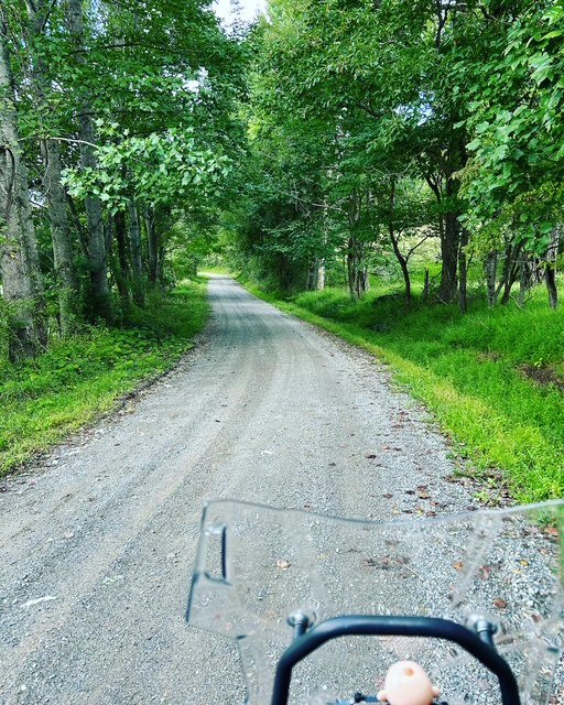
Check our Route Board!
Stop by our store and check out our Route Board! We’ll update and highlight different routes throughout the year. Swing by, scan the QR code and follow one of the routes. Or, download a few of our basic route GPX files below
Route Courtesy Reminder
These routes travel through rural communities—please slow down near homes, be respectful, and ride responsibly. A smile and a wave go a long way.
Ride at your own risk and follow all local laws.
See full route disclaimer at the bottom of the page.
Check out our camping page for ways to stay with us. Just want to do a day trip? We offer parking in our front lot to come up and ride the routes - PLEASE give us a call before you come. Parking is free but TIPS are welcome and can be put in the drop box at our store


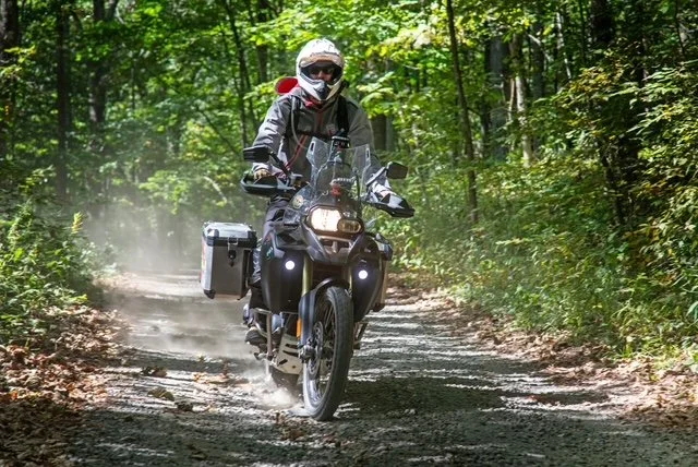

Photo Credit - RoadRUNNER Motorcycle Touring & Travel MagazineRoadRUNNER Motorcycle Touring & Travel magazine came out and did a beautiful article about us for their featured Shamrock Tour®–four day rides out of a base location. You can buy a back issue here to read the full travel story.
Shamrock Route 1
Highlights: Indian Valley x2, New River, Conner Grove, , Gravel Backroads, Rt 8(down), Rt 40, “Shoot the Creek”
125 Miles
Shamrock Route 2
Highlights: Rt 8 (down), Climb Belcher Mountain, Hike the Buffalo, Squirrel Spur, Rt 40, Runnet Bag Rd
118 Miles
Shamrock Route 3
Follow part of the historic Crooked Road Music Trail. Mostly road with some gravel backroads toward the end. Go through Rocky Mount, Boones Mill then cut up Adney and Wades gap, through Callaway up to Floyd. 76.5 miles
Shamrock Route 4
Highlights: Floyd Backroads, Allegheny Springs, Backside of Poor Mountain, Bent Mountain, 12o’clock knob, Mount Chestnut, Bent Mountain Backside, Blue Ridge Parkway
125 Miles
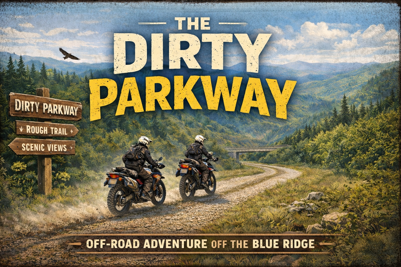
THE DIRTY PARKWAY
A Crooked Mountain Favorite: 170 mile Adventure route - 2 part route that starts and ends at Crooked Mountain. Explore some less traveled roads that parallel the Blue Ridge Parkway. It’s a good mix of hardball, gravel and unimproved roads. Take a break at Mile 97 (by turning right on Shooting Creek road to get back to Crooked Mountain). Grab a drink and snack at the store then head back out for part II. Part II takes you south to the historic Mabry Mill then through backroads with great views of rock churches and Buffalo Mountain
Ride.Camp.Explore
Resources, Partners, Affiliates, and Friends
-

RoadRUNNER Motorcycle & Travel Magazine
RoadRUNNER is an independently owned and published motorcycle touring and travel magazine. On our website, you will find exciting travel stories, reviews, news, and other resources for planning your next motorcycle tour. We offer a wide variety of free content, but only our active web subscribers get access to the entire 650+ tour database, complete with maps and GPS route files. Web subscribers also enjoy exclusive web-only stories.
-

Floyd Tourism
Discover Floyd on 2 Wheels - Request a map
-

Gearhead Junction
We’re lucky to have our friends at Gearhead Junction just about an hour away. They’re a rider-owned dealership and a solid resource for the ADV, touring, and dirt crowd — whether you’re shopping for a new or used bike, gear, or just good advice from people who actually ride.
A lot of the bikes you’ll see around our rallies and local routes came through their shop, and they’ve been great partners in helping grow the riding community in this region.
-

Frontline Eurosports - Salem, VA
We’re proud to work with Frontline Eurosports, a solid go-to for riders who love European bikes. They carry a strong lineup of BMW, Ducati, KTM, Indian, and Triumph motorcycles, along with gear and service from people who actually understand how riders use their machines.
Whether you’re ADV-focused, into sport-touring, or just appreciate well-built bikes, Frontline has been a great partner and supporter of the local riding community.
Go see Pat and Craig in Sales!
-

Bermann Firearm Company
Gunsmithing and Customization, Cerekoting (for Motorcycles and firearms), Laser Engraving, Sales
-

Back of the Dragon
Nestled in the Appalachian Mountains on Virginia’s famed Route 16 lies Back of the Dragon…32 miles of exhilarating winding curves and unparalleled excitement. Stop by the
-

Viking Bags
Viking Bags is the world's largest Manufacturer of motorcycle luggage & after market parts. Viking Bags sells leather and hard saddlebags, for some of the most popular bikes on the market. In addition to saddlebags, Viking Bags offers motorcycle sissy bar bags, solo bags, motorcycle tank bags, motorcycle windshield bags, motorcycle trunks, motorcycle tail bags, motorcycle backpacks, swing arm bags, fork bags, roll bags, handlebar bags, motorcycle baggers bags, and motorcycle tool bags.
Past Motorcycle Specials & Events
-
![Crooked Mountain Moto "Base Camp" Weekend]()
Crooked Mountain Moto Base Camp weekend
-
![2 Wheel Special]()
Camping Promotion for 2-Wheeled Guests
-
![]()
Crooked Mountain Moto Weekend


Motorcycle Route Disclaimer
The motorcycle routes, maps, GPX files, and ride guides provided by Crooked Mountain and Crooked Mountain Moto are for informational and recreational purposes only.Many of these routes go through rural areas where people live. Be courteous and slow down around houses. A smile and a wave go a long way
Motorcycling involves inherent risks, including but not limited to accidents, weather conditions, road hazards, mechanical failure, and other dangers that can result in serious injury or death. Riders assume all risks associated with riding, navigating, or following any route published or shared by Crooked Mountain or Crooked Mountain Moto.We do not guarantee the safety, accuracy, or condition of any road, trail, or point of interest listed. Road conditions, traffic, closures, private property access, and environmental factors may change at any time without notice. Riders are solely responsible for ensuring their motorcycle is in safe operating condition, complying with all traffic laws, and exercising sound judgment when riding.By using any route, map, or related material from Crooked Mountain or Crooked Mountain Moto, you agree to release and hold harmless Crooked Mountain, Crooked Mountain Moto, their owners, affiliates, partners, and representatives from any and all liability for damages, injuries, losses, or claims arising from your participation.Ride at your own risk. Always wear proper protective gear. Obey local laws. Respect private property. Ride responsibly.